If you’re after a contrast to organised races, take a longboat on an exploration of our wonderful coastline. Unlike races, which have planned courses, safety boats and local experts advising on the weather, a journey of exploration requires the crew to be self-sufficient.
This guide is intended to give an interested crew an idea of the questions that need answering and where to find those answers. It is strongly recommended to undertake trips with an experienced local and take as much advice as possible.
Weather
Even benign sea areas can become hazardous in adverse weather. Get as much weather information as possible before committing to a launch and have a low threshold for postponing or cancelling a trip. Local knowledge is invaluable.
Communication
A VHF radio is essential for a coastal trip. Users need a Short Range Certificate, obtained after a one-day shore-based course at an appropriate RYA training facility. Consider informing the coastguard of your intentions by phone or VHF. DSC radios offer significant advantages, particularly when equipped with GPS.
Safety equipment
Usual safety equipment should be supplemented with flares, smoke and possibly an EPIRB/PLB.
Coastal navigation
Sea-kayak guides are useful starting points for a day trip in a longboat, but route times must account for the differences between kayaks and longboats. Buy a chart and set as much of the route as possible before launching.
Tidal stream charts show velocities at hourly intervals. The reference port is noted on the chart and speed is shown for spring tides and neaps. A useful guide is the 50:90 rule: the stream is 0% at slack water, 50% one hour after, 90% at two hours and 100% at three hours, then slows at the reverse rate.
Chart depths are in metres relative to chart datum. A land OS map can help with the coastline but lacks water information. Tide tables and tidal curves help estimate water depth; where no curve is available, the rule of twelfths is a useful approximation.
Navigation marks
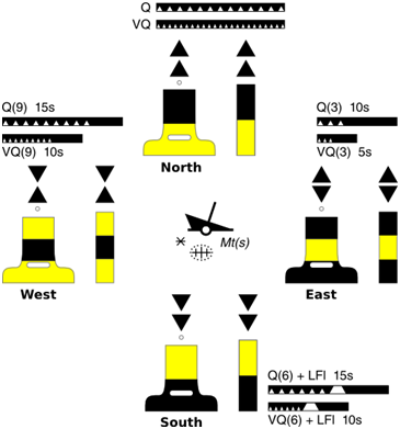
Lateral and cardinal buoyage are the two main systems. Green is starboard/right and red is port/left. When entering a harbour, green conical marks stay to starboard and red cans to port. Cardinal buoys mark the safe side of an obstacle (ie a WEST mark is to the WEST of the obstruction) using compass directions and cone topmarks.
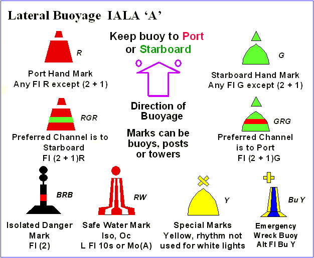
Lateral buoyage