If you’re after a contrast to organised races, take a longboat on an exploration of our coastline. Unlike races, which have planned courses, safety boats and local experts advising on the weather, a journey of exploration requires the crew to be self-sufficient.
This guide is intended to give an interested crew an idea of the questions that need answering. It is strongly recommended to undertake trips with an experienced local and take as much advice as possible.
Weather
Even benign sea areas can become hazardous in adverse weather. Get as much weather information as possible before committing to a launch and have a low threshold for postponing or cancelling a trip. Local knowledge is invaluable.
Communication
A VHF radio is essential for a coastal trip. Users need a Short Range Certificate, obtained after a one-day shore-based course at an appropriate RYA training facility. Consider informing the coastguard of your intentions by phone or VHF. DSC radios offer significant advantages, particularly when equipped with GPS.
Coastal navigation
Get a chart of the area and plan the route before launching. Tidal stream charts show velocities at hourly intervals; navigation charts show depth, hazards and marks. As a rough guide, tidal stream strength follows the 50:90 rule: 0% at slack water, 50% one hour after, 90% at two hours and 100% at three hours, then slowing at the reverse rate.
Depths on charts are in metres relative to chart datum. Due to their shallow draught, much longboat navigation follows the principle of see and avoid, but a basic knowledge of navigation marks is useful.
Navigation marks
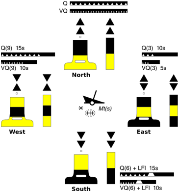
Lateral and cardinal buoyage are the two main systems. Green is starboard/right and red is port/left when entering a harbour. Cardinal buoys mark the safe side of an obstacle using compass directions and cone topmarks.
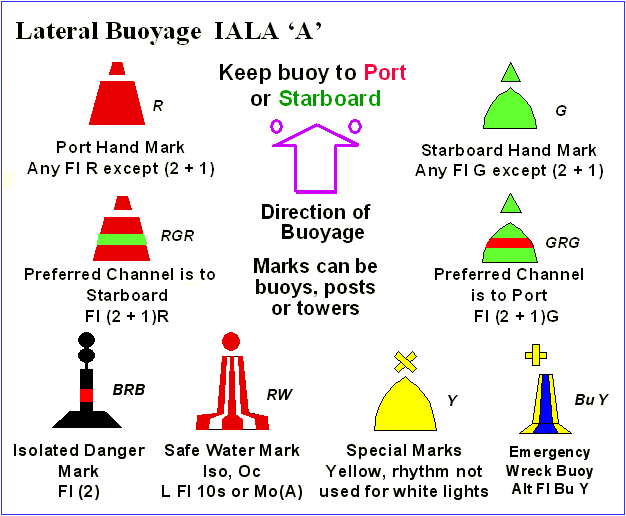
Lateral buoyage